hike

Rattray Marsh Conservation Area in Mississauga

For all you nature lovers who are looking for a quick escape from the busy city life, Rattray Marsh Conservation Area is a great spot for a short hike. Located in Mississauga, the lakefront wetland offers a unique experience to see various birds, small critters, numerous trees species and plants. This is a pretty neat place to visit since it’s the last remaining lakefront marsh between Toronto and Burlington. 

There are several trails and boardwalks added as part of Rattray Marsh’s design to preserve and keep the natural area undisturbed. Within the Conservation Area, there are three trails: Knoll Trail (0.3 km), Secondary Trail (1.8 km) and Pedestrian Trail (1.1 km). The trails are pretty easy, so it shouldn't take too long to finish. 

One of the trails will take you by the Lake Ontario’s shoreline where you can catch a view of Toronto out in the distance. If you continue down the shoreline, you can see the marsh up close, which is pretty neat. Go and see what wildlife you can spot! 

NOTES:

  • Location: There are two points of access - You can either park and walk in at 1180 Lakeshore Road West or walk in from 50 Bexhill Road. 
  • Hours of Operation: Opens after sunrise and closes before sunset daily.
  • Admission Fee: There’s a donation box at the main kiosk of Bexhill entrance.
  • Dogs Allowed: If you bring a canine companion, make sure they are leashed.
  • Not Permitted: Please note that there’s no cycling here or fishing permitted here.

Happy Adventuring! 

A Taste of Mars: Cheltenham Badlands In Caledon

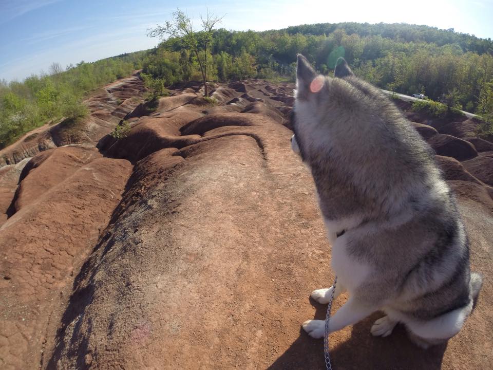
For its reddish hue, rolling hills with streaks of greyish-green and leafy trees surrounding the area, the Cheltenham Badlands offer an incredible view in Ontario. Composed of iron-rich Queenston Shale, the unique red landscape was created due to poor farming practices in the 1930's which caused overgrazing of the land. The exposed bedrock eroded into a series of striking ridges and gullies. Because the rock is so sensitive, it erodes easily, creating those rolling, red dunes that look like you're on Mars. As one of the best examples of "badlands topography" in Ontario, the Cheltenham Badlands are a geological treasure!

Let's get started!

Off Hwy 10, turn onto Old Baseline Road and head down until you reach the badlands. There's a small parking lot off the side of the road.

Notes:

  • The term "badlands" refers to land that is highly eroded, barren and dry. 
  • The area is very fragile, so don't climb on the hills when the ground appears soft. 
  • Be sure to check it out before it's temporarily closed. A protective fence will be placed along Olde Baseline Road at the end of May 2015.
  • Update: Public access to the badlands is only available at the viewing area at the top of the badlands slope. 

Devil's Punch Bowl Falls in Hamilton

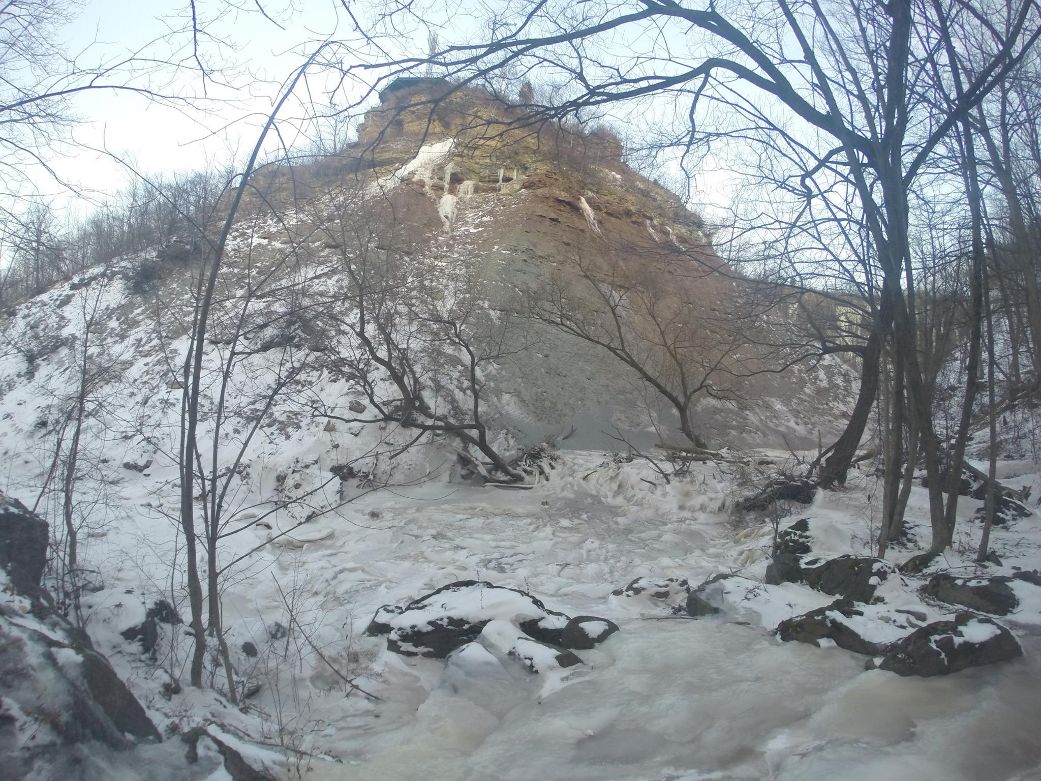
Devil's Punch Bowl Falls is a unique waterfall located on the Niagara Escarpment in Stoney Creek, Ontario. Known for its distinctive horseshoe multi-coloured cliff, it offers an absolutely breathtaking view.

Let's get started! 

Before you start the hike, you can explore the area to see the view of the falls from the top. You'll also see a 10-metre high cross that overlooks the community. 

When you're ready, head towards the bench where you'll see a side trail marker. The trail will take you down a zig-zag path down a steep incline until you reach the bottom of the escarpment. Turn left and continue following the trail. Along the way, you'll find wooden stairs that take you down towards the river. 

From here, the goal is to take the main trail upstream until you reach the Lower Falls. There's a bunch of side trails that will take you on more difficult paths that I probably wouldn't try again. Climb up past the Lower Falls and keep following the trail. When you get closer to Devil's Punch Bowl Falls, follow the trails that are closer to the river because I noticed that some trails head uphill and away from the falls. 

You'll reach a point where the trail leads you down to the river. Use the tree roots to climb down onto the riverbed. Now head upstream towards Devil's Punch Bowl Falls and you'll be rewarded with an amazing view of the falls.

NOTES: 

  • The hike takes about 30 min - 1 hour depending how fast you move. 
  • There's a free parking lot at Ridge Road west of Centennial Parkway S. 
  • This hike is ideal during dryer weather because you'll need to hike along the riverbed to make it to the falls. If the water flow is too heavy, you won't be able to reach it. Also, mud makes everything slippery, especially the beginning of the hike. 
  • Be careful on the hike because some parts have a narrow path with a cliff beside it. 
  • Try going in the winter to see a frozen waterfall!

Happy Adventuring!